Geological Mapping · mapping-4-2
Slope-gradient map
Slope classes support terrain segmentation and field-access or mass-movement interpretation.
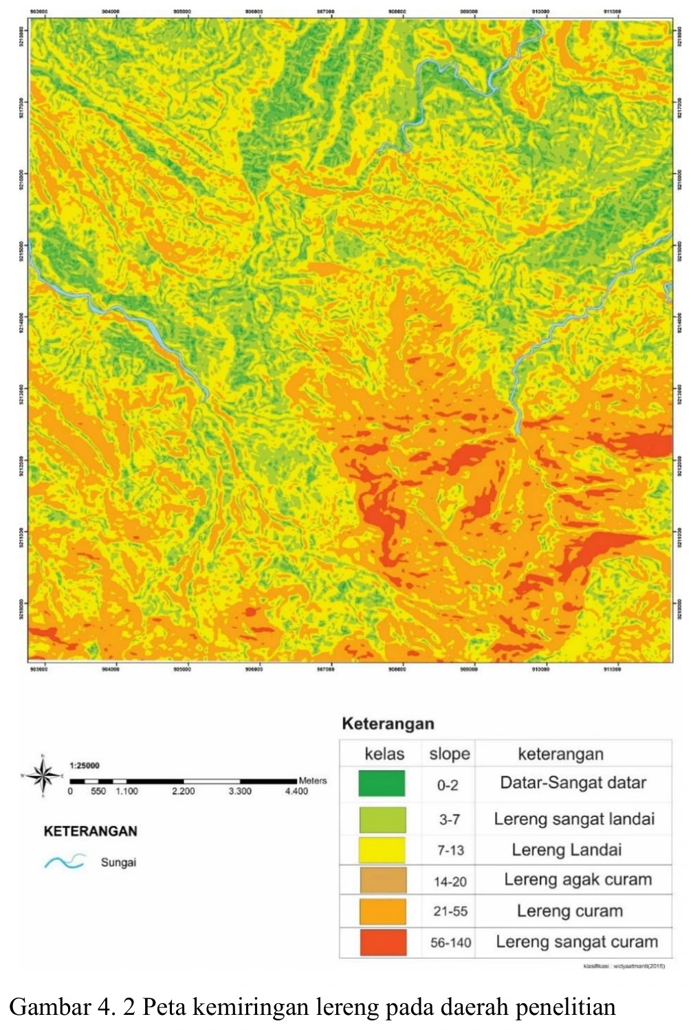
Figure content
Slope classes support terrain segmentation and field-access or mass-movement interpretation.
Interpretive role
Retain after class/units audit.
Technical context
Recalculate slope units and class limits. A reported 140% slope is possible as percent rise but must not be confused with degrees. State algorithm, cell size and smoothing.
- Geological mapping
- Spatial reasoning
- Map interpretation
Source record
PDF page 56 Original figure caption: Peta kemiringan lereng pada daerah penelitian.
- Source
- PDF page 56
- Quality
- Source scan
- Record ID
- mapping-4-2