Geological Mapping · mapping-4-1
Geomorphology base map
Elevation distribution used to define relief, watershed position and the topographic context of mapped units.
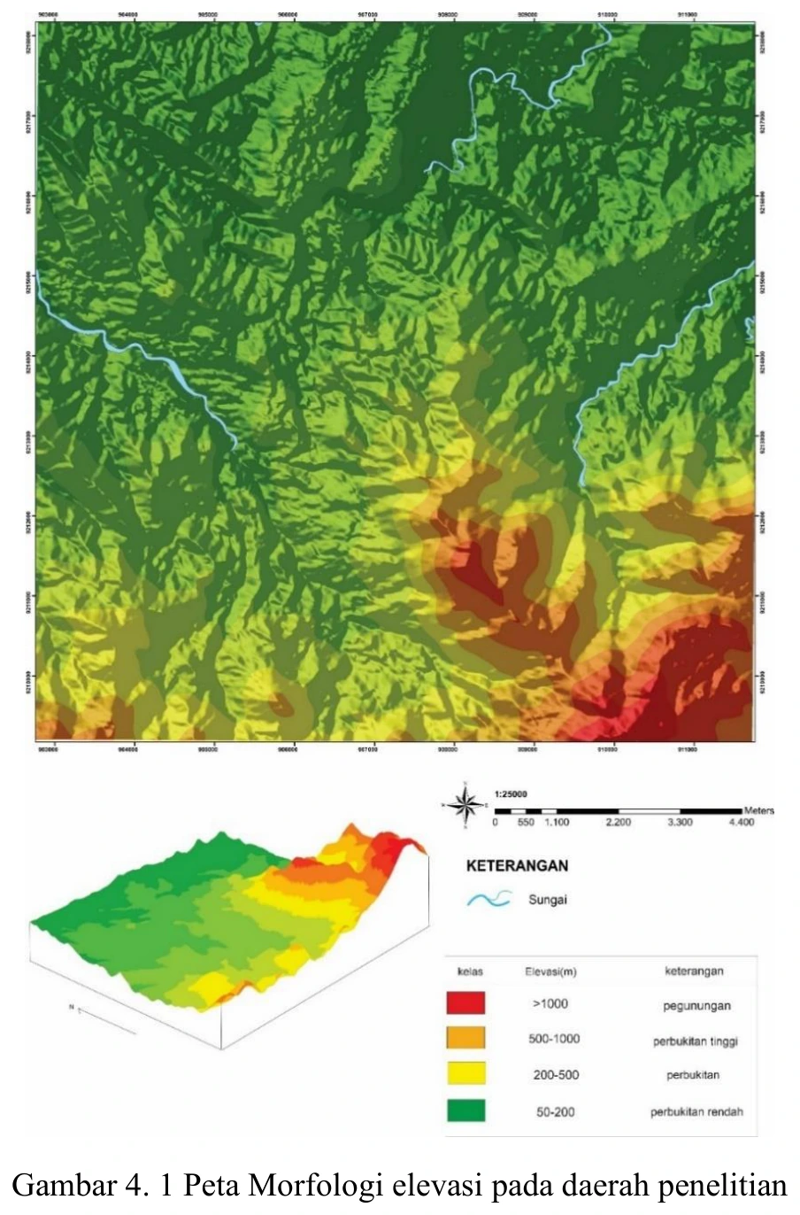
Figure content
Elevation distribution used to define relief, watershed position and the topographic context of mapped units.
Interpretive role
Retain after metadata correction.
Technical context
Verify DEM source, pixel size, vertical datum, CRS, colour breaks and whether relief classes are data-driven. Elevation alone does not establish lithology or structure.
- Geological mapping
- Spatial reasoning
- Map interpretation
Source record
PDF page 55 Original figure caption: Peta Morfologi elevasi pada daerah penelitian.
- Source
- PDF page 55
- Quality
- Source scan
- Record ID
- mapping-4-1