Geological Mapping · mapping-4-5
Drainage-pattern map
Drainage geometry is used to assess terrain and possible lithologic or structural control.
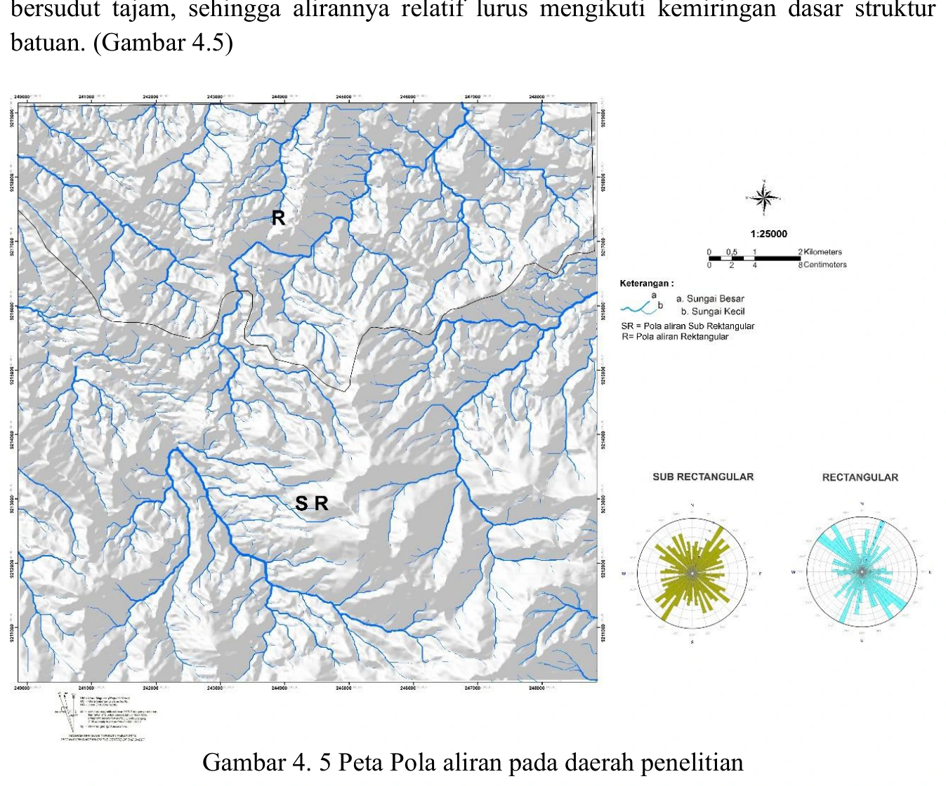
Figure content
Drainage geometry is used to assess terrain and possible lithologic or structural control.
Interpretive role
Retain after method audit.
Technical context
Specify stream extraction threshold, ordering method and quantitative basis for pattern names. Do not infer faults solely from straight reaches.
- Geological mapping
- Spatial reasoning
- Map interpretation
Source record
PDF page 60 Original figure caption: Peta Pola aliran pada daerah penelitian.
- Source
- PDF page 60
- Quality
- Standard
- Record ID
- mapping-4-5