Pit N Thesis · thesis-4-45
Structure contour and distribution — Seam B2
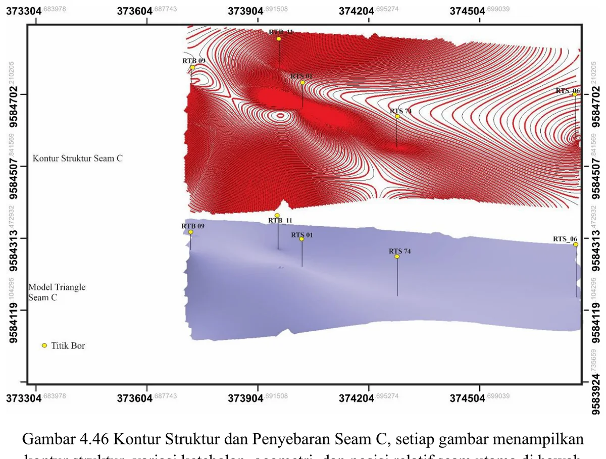
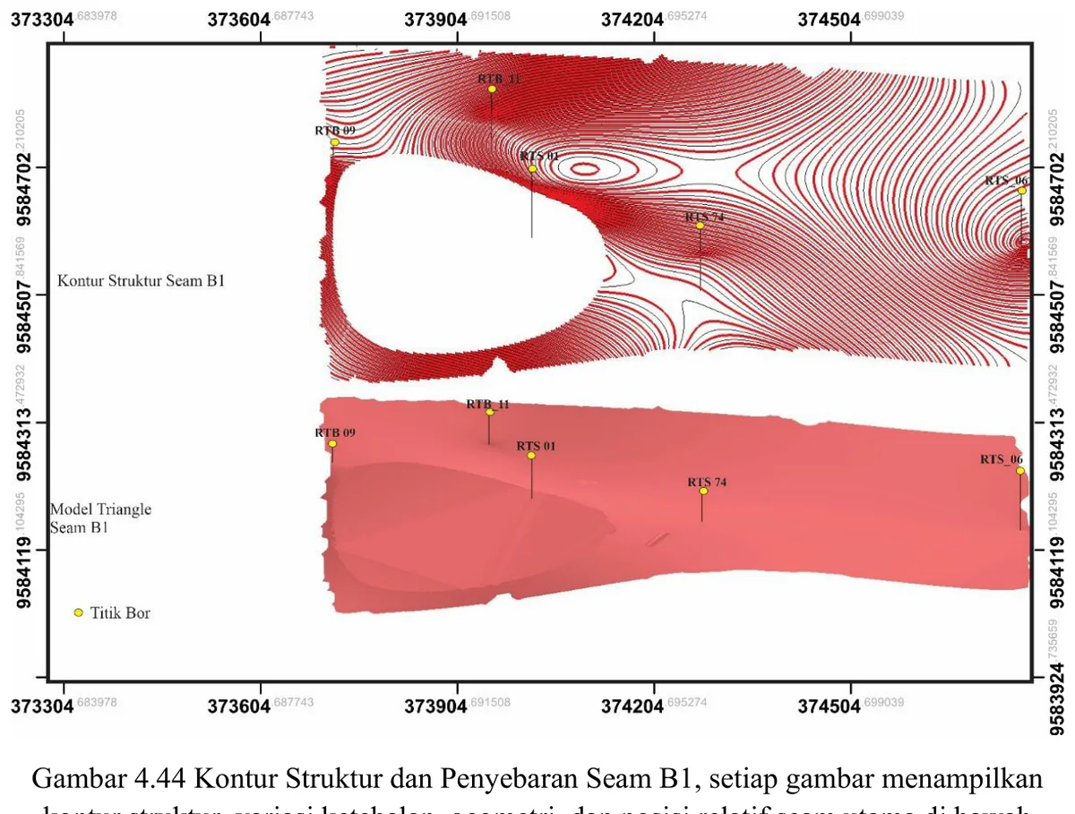
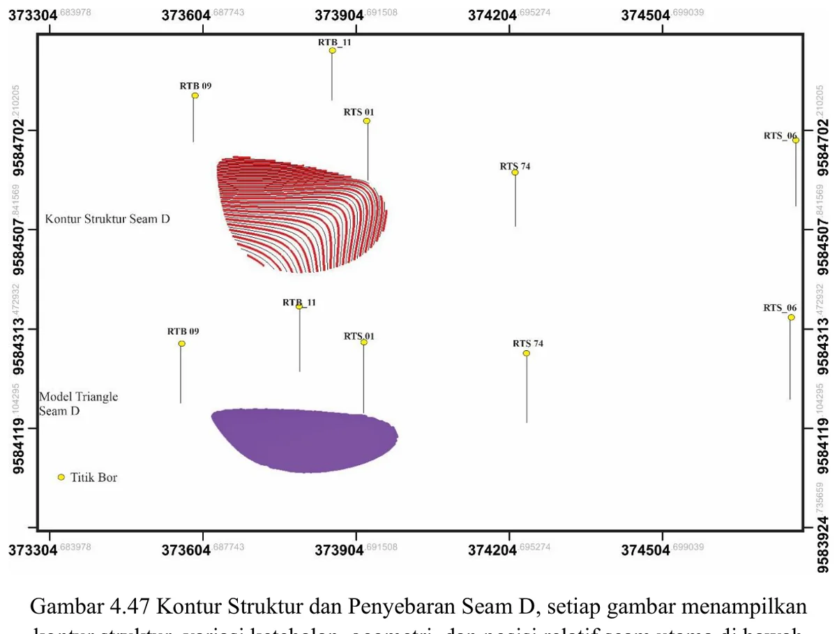
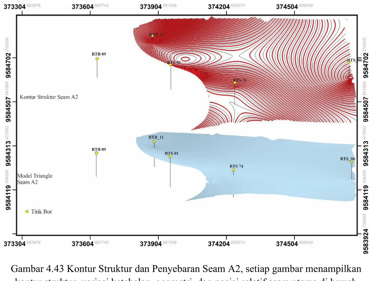
The structure-contour map and surface represent the interpreted elevation of Seam B2.
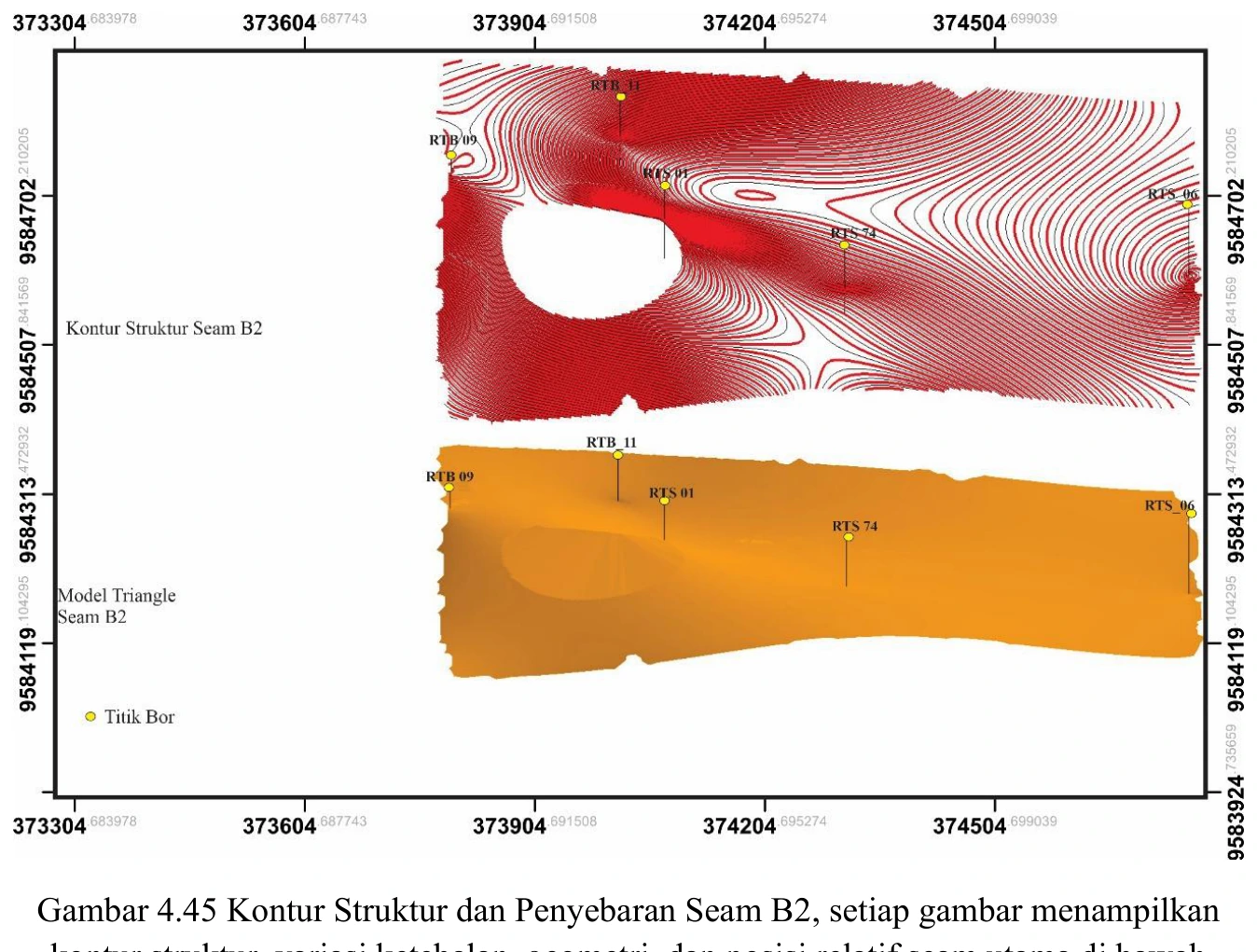
Figure content
The structure-contour map and surface represent the interpreted elevation of Seam B2.
Interpretive role
Audit input picks, interpolation method, grid resolution, edge effects and residuals at boreholes.
Technical context
Seam-surface geometry and distribution.
- 3D geological modelling
- Surface validation
- Spatial QA
Source record
PDF page 180 Original figure caption: Kontur Struktur dan Penyebaran Seam B2, setiap gambar menampilkan.
- Source
- PDF page 180
- Quality
- Source scan
- Record ID
- thesis-4-45