Pit N Thesis · thesis-4-1
Research-area geological map and Pit N drillhole control
The map locates the research area and boreholes that constrain the geological interpretation.
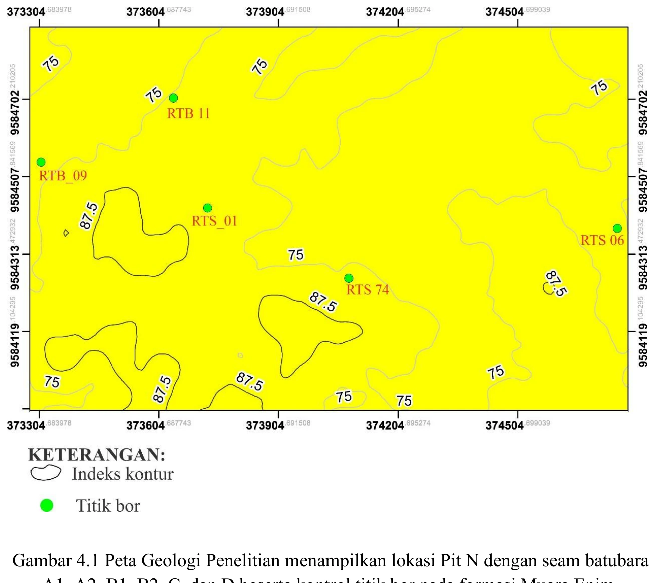
Figure content
The map locates the research area and boreholes that constrain the geological interpretation.
Interpretive role
Check coordinate system, drillhole distribution, spacing and whether mapped boundaries are observed or inferred.
Technical context
Spatial control for the stratigraphic and modelling workflow.
- Geological mapping
- Spatial reasoning
- Map interpretation
Source record
PDF page 69 Original figure caption: Peta Geologi Penelitian menampilkan lokasi Pit N dengan seam batubara.
- Source
- PDF page 69
- Quality
- Source scan
- Record ID
- thesis-4-1