Geological Mapping · mapping-4-39
Geological cross-section
Section integrates map units, topography, bedding and structures.
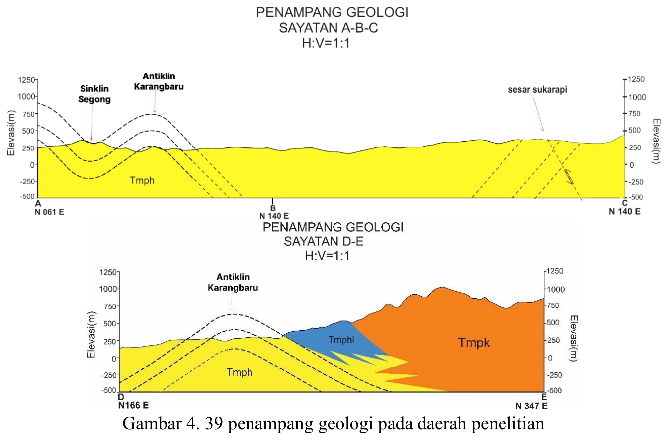
Figure content
Section integrates map units, topography, bedding and structures.
Interpretive role
Retain after map–section validation.
Technical context
Check section trace, apparent versus true dip, unit thickness, fault geometry, fold closure and consistency with the map. Do not use unconstrained subsurface geometry as certain.
- Structural analysis
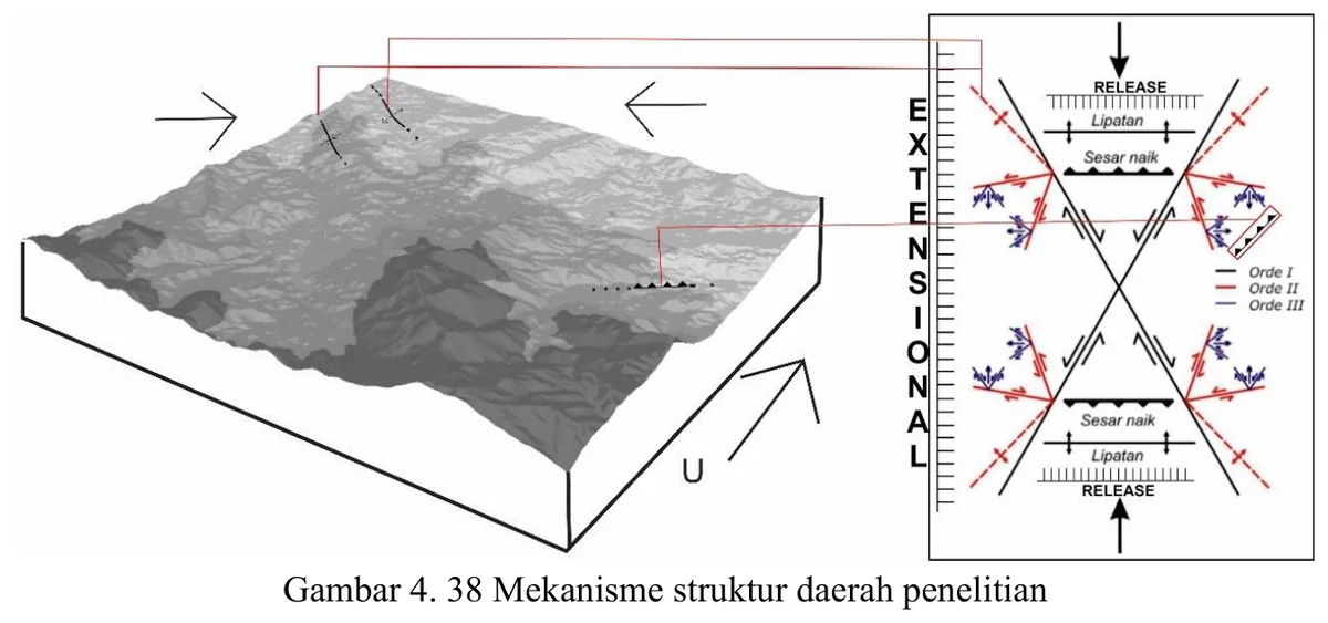
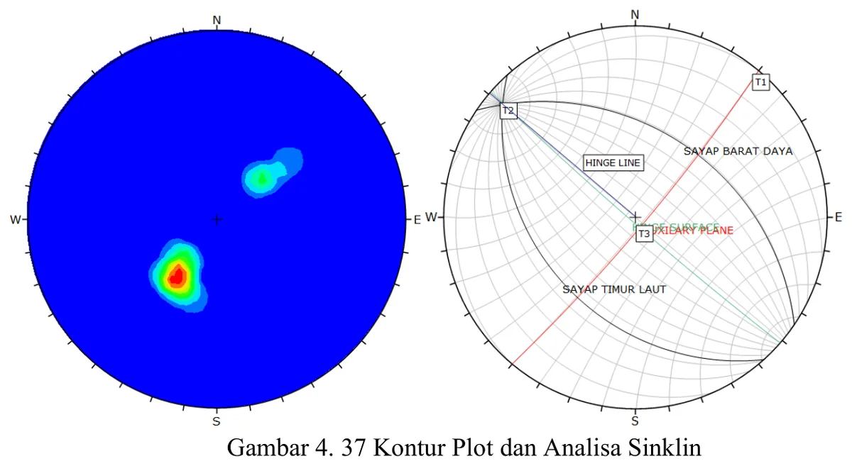
- Stereonet reasoning
- Cross-section logic
Source record
PDF page 85 Original figure caption: penampang geologi pada daerah penelitian.
- Source
- PDF page 85
- Quality
- Source scan
- Record ID
- mapping-4-39