Geological Mapping · mapping-4-17
Palaeobathymetric range chart for LP59
Ecological ranges are combined to infer depositional depth.
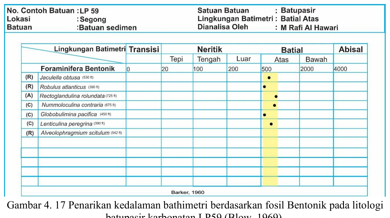
Figure content
Ecological ranges are combined to infer depositional depth.
Interpretive role
Reinterpret with assemblage method.
Technical context
The deepest and shallowest reported ranges cannot be mechanically treated as depositional depth. Use assemblage dominance, abundance, preservation and transported specimens.
- Micropalaeontology
- Biostratigraphy
- Source-limited taxonomy
Source record
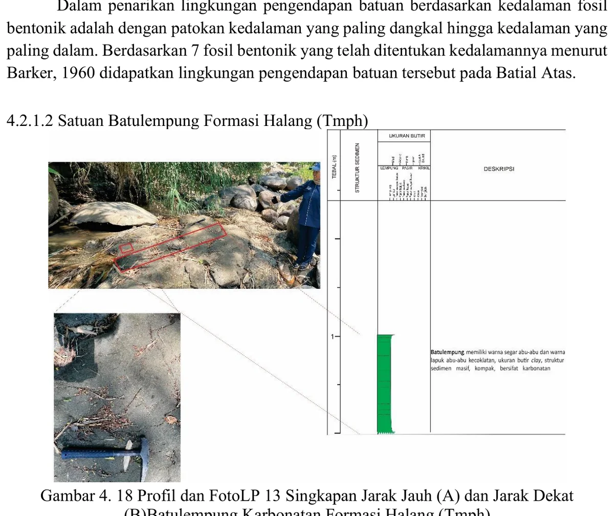
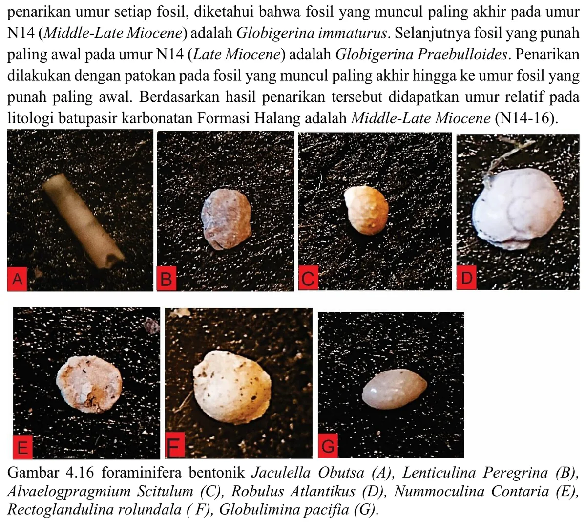
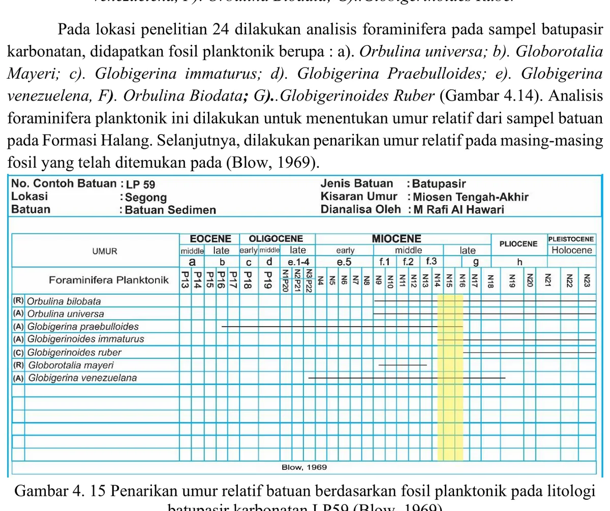
PDF page 69 Original figure caption: Penarikan kedalaman bathimetri berdasarkan fosil Bentonik pada litologi.
- Source
- PDF page 69
- Quality
- Standard
- Record ID
- mapping-4-17