Mapping & Petrography Appendices · appendix-07
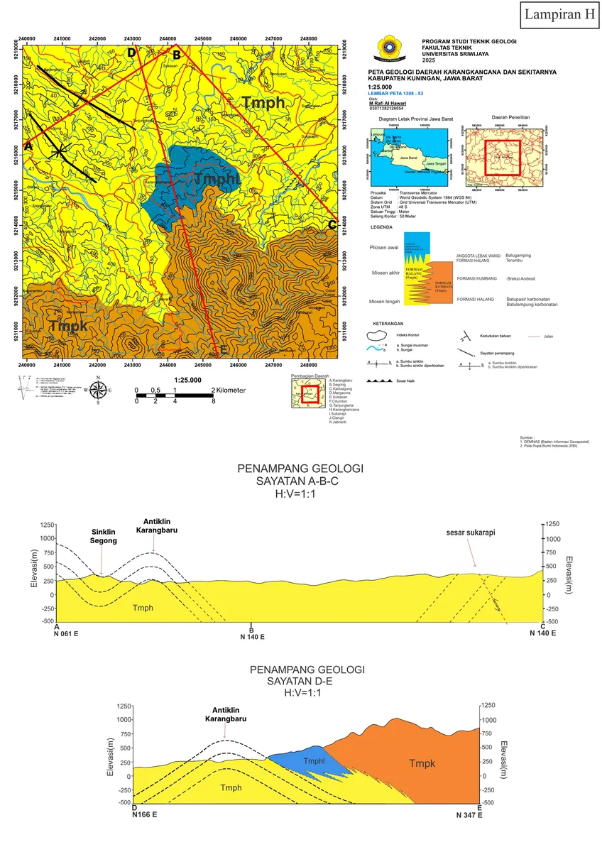
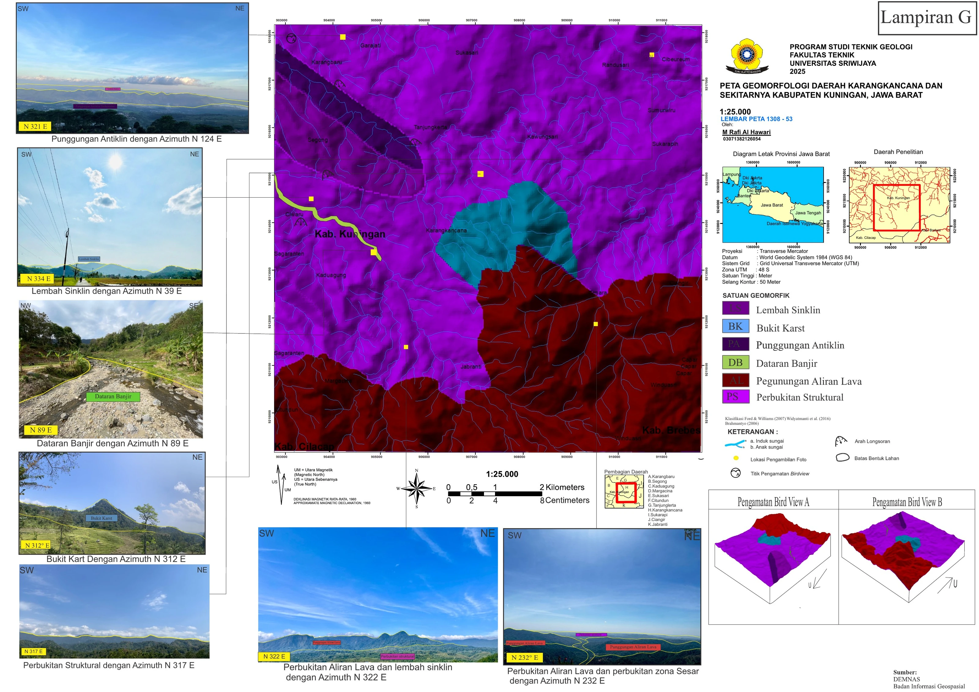
Final Geomorphological Map — Sheet 07
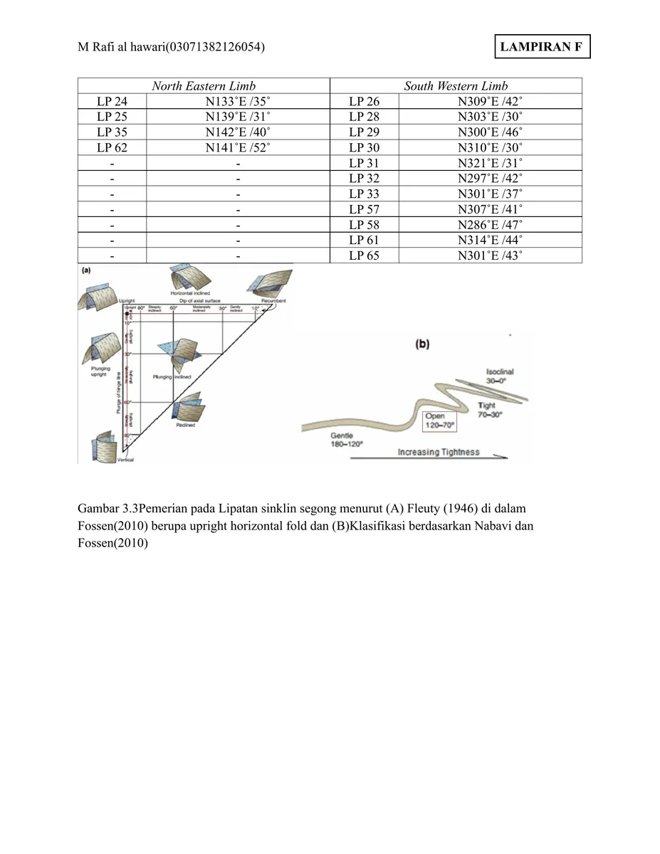
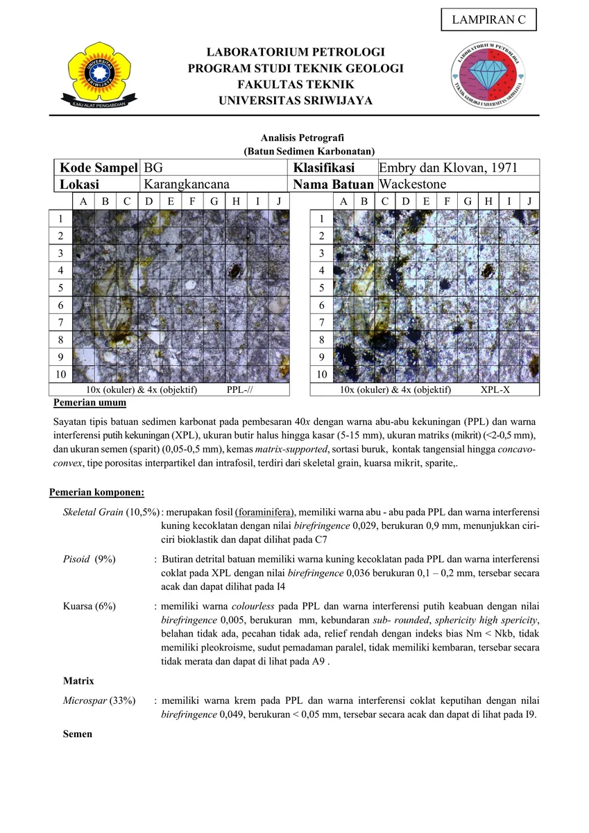
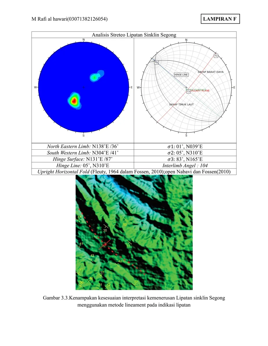
Final Geomorphological Map — Sheet 07 compiles the mapped units, boundaries and spatial control used in the project.
Record content
Final Geomorphological Map — Sheet 07 compiles the mapped units, boundaries and spatial control used in the project.
Project context
The figure provides the geographic framework for comparing field observations, boreholes, sections and later interpretation.
Technical relevance
Geological mapping, spatial control and GIS-based synthesis.
- Geological mapping
- Spatial reasoning
- Map interpretation
Source record
Original figure caption: Final Geomorphological Map — Sheet 07.
- Source
- Source image or document
- Quality
- HD
- Record ID
- appendix-07